Volumetric stockpile measurement
Measure stockpiles, silos, bins, bunkers, bays, open-yard storage, fill levels, deliveries, and extractions.
 LifeLine Technologies
 Volumetric measurement and inventory intelligence
LifeLine deploys LiDAR-based systems for volumetric measurement, fill level, deliveries, extractions, and capacity across aggregates, mining, agriculture, municipal materials, oil & gas, and industrial storage. Know what changed between manual checks, drone scans, and month-end reporting.
Featured application
LifeLine deploys QbVolume where continuous volumetric measurement for stockpiles, fill level, deliveries, extractions, reorder timing, and capacity planning need to stay current between manual checks, drone scans, and reporting cycles.
What we deploy today
LifeLine deploys LiDAR-based volumetric measurement systems around real industrial environments: what material needs to be measured, where sensing can be installed, and how inventory output supports an operating decision.
Measure stockpiles, silos, bins, bunkers, bays, open-yard storage, fill levels, deliveries, and extractions.
Use 3D LiDAR to track material geometry, capacity, reorder timing, and changes between audits or drone scans.
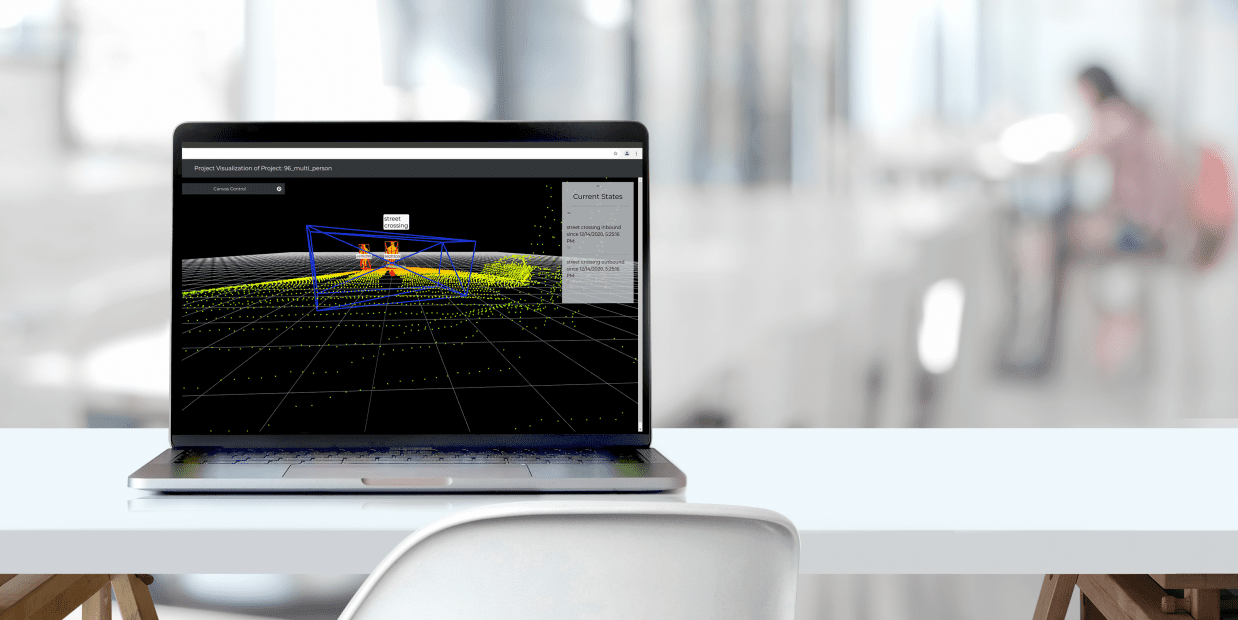
Support material and site review where fog, glare, darkness, weather, reflection, or low contrast can limit conventional camera views.
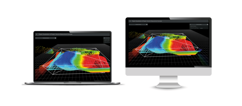
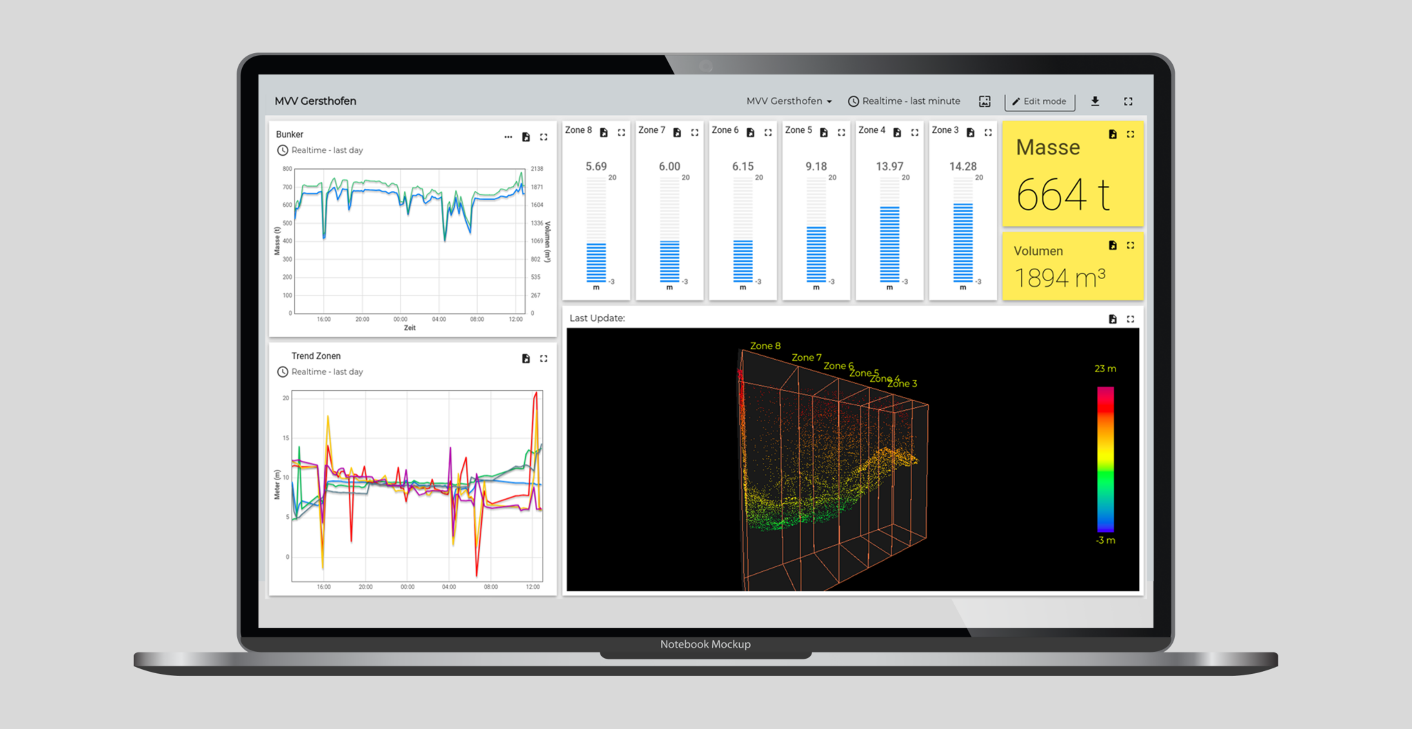
The useful view is the operating record: measured volumes, current values, alarm status, trends, and material changes a team can review.
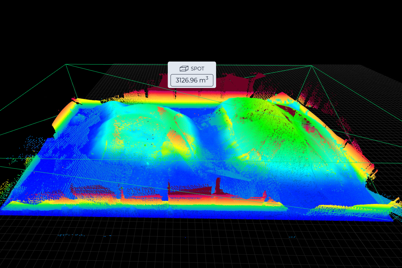
Uneven material surfaces can be translated into zones, fill levels, stockpile volume records, and change history.
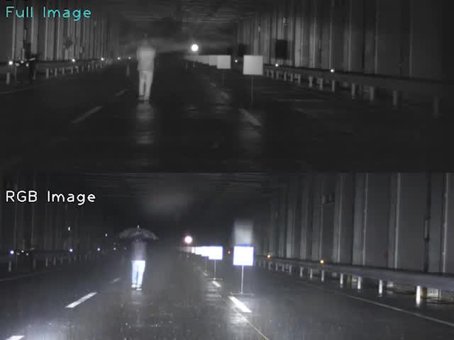
The useful signal is clearer review context when fog, glare, darkness, or low contrast affects material handling and site operations.
Industrial applications
LifeLine focuses first on volumetric measurement for bulk material inventory, then supports adjacent site conditions that affect daily operations: material state, site movement, and visibility.
Operating records
LifeLine defines what gets measured, when an inventory condition matters, and where the result should appear for the team responsible for action.
LiDAR systems convert stockpile geometry into volumetric measurement, fill level, deliveries, extractions, and capacity across defined material zones.
LifeLine maps piles, silos, bins, bunkers, bays, and open storage into measurement areas, thresholds, and review logic.
The result reaches the team as a dashboard, alert, report, API event, or inventory record that supports planning and reconciliation.
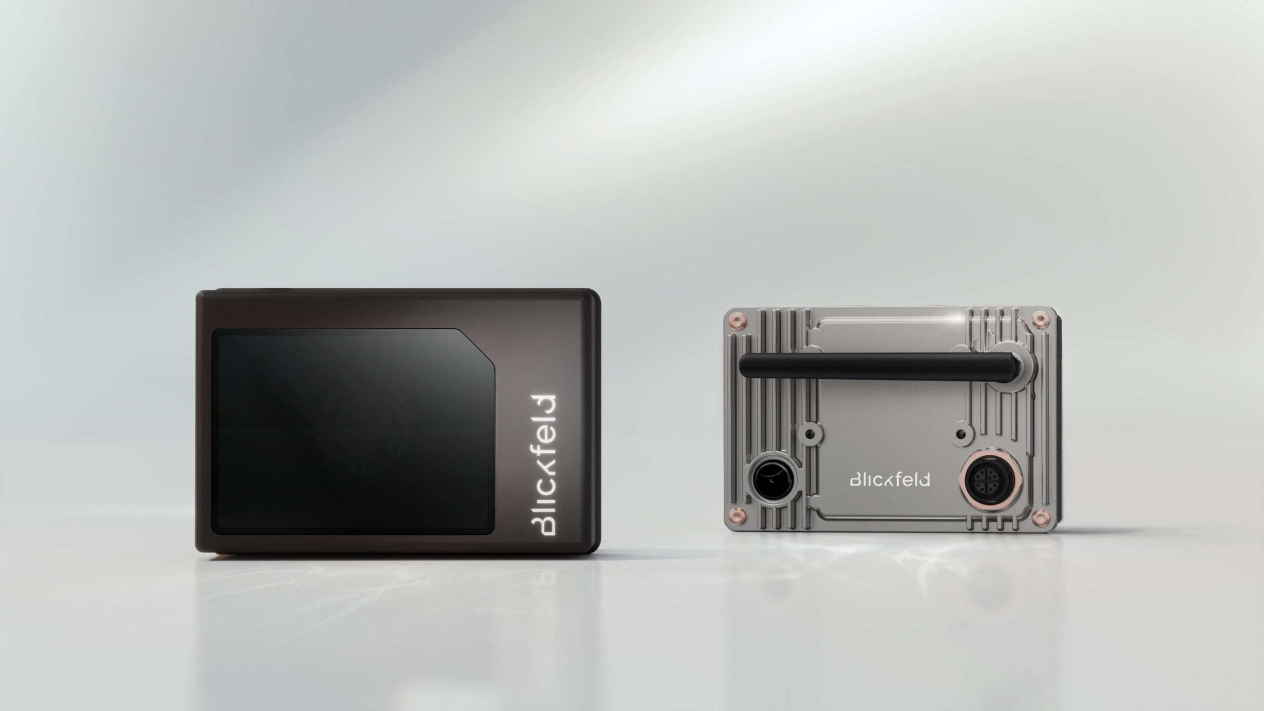
Powered by Blickfeld
Qb2 provides 3D measurement and edge-ready processing in a compact sensor. LifeLine designs placement, zones, thresholds, data delivery, and operational handoff around the material site.
Explore Qb2Partner technology
LifeLine works through commercial partnerships with sensing technology providers while keeping manufacturer-level product claims with the partner companies.
What the review clarifies
About LifeLine
LifeLine keeps deployment planning grounded in site fit, material workflows, output needs, and the operating decision the measurement must improve.
LifeLine Technologies
Bring us the site, material, and reporting gap. LifeLine will review whether a LiDAR-based inventory intelligence deployment is the right fit.